

As we end our summer series on water safety, our final focus will be on the road signs of the water – red and green markers. Most of the markers and buoys you will see will be either red or green, and these colors help identify which side you will want to pass them on to remain in a channel.
As a general rule of thumb, when you are heading from open water to inland water, or heading upstream in a river, you will want to keep the red markers to your right and the green ones to your left. So, when you are heading from the ocean into a bay, or from a bay into a creek, harbor, or port, the red markers belong on your right side.
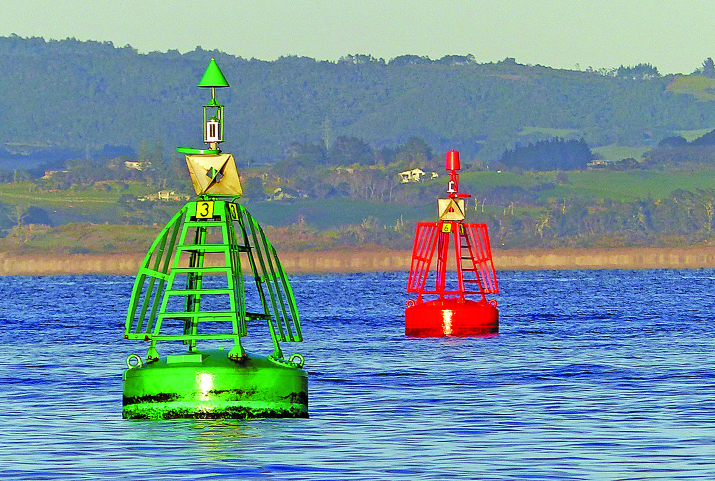
Red Colors, Lights & Even Numbers – these mark the edge or the channel on the starboard (right) side as you enter from open sea or travel upstream.
Green Colors, Lights & Odd Numbers – the edge of the channel is on the port (left) side as you enter from open seas or travel upstream.
Red & Green Colors with Lights – these aids of navigation are located at the junction of two channels and indicate the preferred channel where they split. In this case, the color that’s highest on the markers indicate the preferred or primary channel.
Hence, the old saying, “red right returning.” This universal phrase helps inexperienced boaters to learn how to navigate and use the aids. This expression refers to the fact that when entering a channel from the open sea or proceeding upstream, a boater must keep the red aids on the starboard (right) side of the boat.
There are variations to the U.S. Coast Guard AIS. When on the Mississippi River and its tributaries above Baton Rouge, La., and several other rivers flowing into the Gulf of Mexico, boaters must follow a system called the Western Rivers Marking System. Numbers displayed below daymarks along this system are not associated with the right or left side of the channel. Instead, these numbers indicate distance from the river’s mouth.
An exception is the Ohio River, where they indicate distance for the headwaters.
The Intercoastal Waterway (ICW) is a chain of local channels linked together to provide an inland passage along the Atlantic and Gulf of Mexico coasts. Channels that are part of the ICW are identified by yellow symbols on channel buoys and markers. Note that the color of the buoys will typically correspond to the “red, right, returning” scheme.
Play it safe by Keeping an Eye on Safety. When you encounter a colored buoy, read it, react accordingly and you will be a safe boater.


