By Michael Sznajderman
Alabama NewsCenter

Over the past decade, the Birmingham area has seen a surge in the number of parks, green spaces, walking and bicycle trails. With more people getting out of their cars, there’s growing interest in how to better connect attractions such as Railroad Park, Ruffner Mountain Nature Preserve, Oak Mountain State Park and the Dunnavant Valley Trail, and make communities across the Birmingham region more walker- and biker-friendly.
Officials with the Regional Planning Commission of Greater Birmingham (RPCGB) are trying to address that interest. They are in the early stages of devising a regional pedestrian and bicycling master plan, and they want the public’s input, through the new, “B Active Plan.”
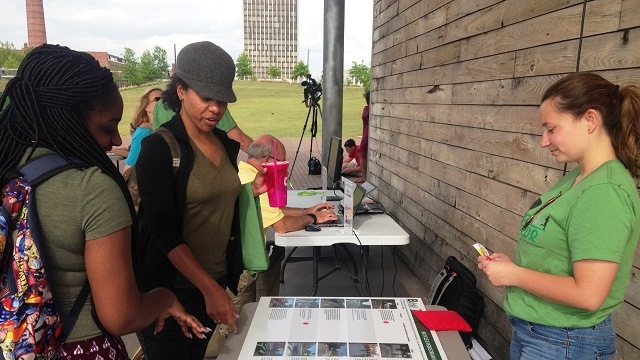
Planning and community leaders kicked off the B Active Plan this week with several events in Jefferson and Shelby counties, including an open house on Tuesday at Railroad Park. More information is available at https://b-activeplan.com/.
“We really want to engage the public, to help us determine what projects are needed, such as more walking and biking trails, to create a more connected network of safe places to walk, bike and get around – without having to use a car,” said Lindsay Puckett, RPCGB project manager.
While more people are walking and riding bicycles in the Birmingham region, Census data show that only 1 percent of area residents walk or bike to work. The lack of bicycle lanes and sidewalks, and geophysical barriers, such as Red Mountain and Shades Mountain, can also inhibit area pedestrians and bicyclists.
She said the recommendations in the plan will be based on public input and previous planning efforts, such as Jefferson County’s Red Rock Ridge and Valley Trail System plan. It will also include a demand analysis that incorporates demographic data, such as car ownership and employment density, with information about locations that can be “bicycle/pedestrian generators,” such as transit stops and hubs, bikeshare stations, parks, greenways, schools, colleges, and universities, and shopping centers.
Puckett said the B Active Plan will try to identify priorities as far as roads and intersections that need bicycle lanes, and the best routes to connect major parks and attractions so that people can safely walk or ride bicycles from one to another.
To put it more bluntly: what improvements would encourage you to ditch the car keys and walk or bike more often?
The study will look at both Jefferson and Shelby counties, as well as portions of St. Clair and Blount counties. RPCGB officials have contracted with Toole Design Group, a nationally known planning and engineering firm that specializes in bicycle and pedestrian transportation, to help put together the plan.
The public can help right now by going to the B Active website and filling out a survey. Interested individuals can also provide their input to an interactive map of the region, by helping identify barriers to safe walking in their communities, or their preferred bike routes.
“We want to hear from as many people as possible, so that we end up with a plan that truly represents our community, and identifies the locations where it will make the most sense to invest in new walking and bicycling infrastructure,” Puckett said.


